Skalica District (Okres Skalica)
Skalica District (okres Skalica) is a district in the Trnava Region of western Slovakia. It lies in the northern part of Záhorská nížina, a lowland between Bratislava and Czech Republic. The district was established in 1923 and its current borders have existed from 1996. Its largest town is its seat Skalica.
The main branch of the district's economy is industry.
Important cultural sights are the historical center of the town Skalica and a church in Kopčany, one of the oldest buildings in Slovakia, originating from the Great Moravian period.
Skalica District consists of 18 municipalities; in three of them are towns.
* Brodské
* Dubovce
* Chropov
* Gbely
* Holíč
* Kátov
Map - Skalica District (Okres Skalica)
Map


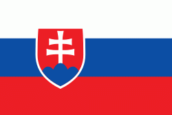
Country - Slovakia
 |
 |
| Flag of Slovakia | |
The Slavs arrived in the territory of present-day Slovakia in the fifth and sixth centuries. In the seventh century, they played a significant role in the creation of Samo's Empire. In the ninth century, they established the Principality of Nitra, which was later conquered by the Principality of Moravia to establish Great Moravia. In the 10th century, after the dissolution of Great Moravia, the territory was integrated into the Principality of Hungary, which then became the Kingdom of Hungary in 1000. In 1241 and 1242, after the Mongol invasion of Europe, much of the territory was destroyed. The area was recovered largely thanks to Béla IV of Hungary, who also settled Germans, leading them to become an important ethnic group in the area, especially in what are today parts of central and eastern Slovakia.
Currency / Language
| ISO | Currency | Symbol | Significant figures |
|---|---|---|---|
| EUR | Euro | € | 2 |
| ISO | Language |
|---|---|
| HU | Hungarian language |
| SK | Slovak language |